-
-
-
-
-
-
-
-
-
-
-
-
-
Tomahawk Lagoon
-
-
-
-
-
-
-
-
-
-
-
-
-
-
-
-
-
-
Tomahawk Lagoon
Description:
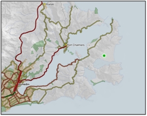
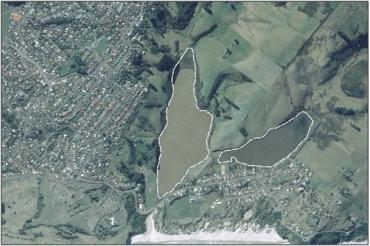
Two shallow brackish water lagoons joined by a narrow channel and sharing a common sea outlet located on the outskirts of Dunedin, at the southern end of the Otago Peninsula. Sea outlet often blocked. 1
Type/Class:
Marsh 2
Size:
31.4 ha.
Altitude:
0-20 m above sea level.
Approximate location:
East of the intersection of Minto Street and Tomahawk Road, Dunedin.
NZTM (centre point): E1409520 N4913950
Regional Plan: Water for Otago.
Schedule 9 Regionally Significant Wetland, no.154, Map F54.
Territorial Authority:
Dunedin City Council.

Recorded Values:
Value |
Description |
|
|---|---|---|
A1 |
|
|
| A4 |
|
|
| A5 |
|
|
A8 |
|
|
A2, A3, A6, A7, A9 |
No relevant information is currently held by the ORC. |
Other Information:
•Part of the area includes QEII covenant 5/12/049A.
•Listed as an Area of Significant Conservation Value in the Dunedin City District Plan. Described as lowland lake with reed swamp, and of regional and local significance. “28”
•Presence of: Isolepis basilaris, which has a threat status of nationally endangered; Maori musk (Mimulus repens), which has a threat status of naturally uncommon; bushy peppercress (Lepidium desvauxii); Lastreopsis microsora; Hydrocotyle hydrophila; Lilaeopsis novae-zelandiae; Chenopodium glaucum subsp. ambiguum; Crassula sinclairii; water milfoil (Myriophyllum triphyllum); salt marsh ribbonwood (Plagianthus divaricatus); tarawera (Epilobium pallidiflorum); sand bidibid (Acaena pallid); Coprosma repens; mudwort (Limosella lineata); kōpūngāwhā (Bolboschoenus caldwellii); Carex testacea; three-square (Schoenoplectus pungens); Triglochin striata; raupo (Typha orientalis); Lepilaena bilocularis, which has a threat status of naturally uncommon; and horned pondweed (Zannichellia palustris). “66”
•Trout present. “67”

Aerial view of Tomahawk Lagoon (March 2006)

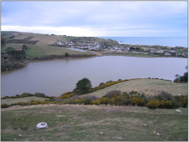
Overview of the western lagoon, with the mouth of the eastern lagoon in the background, Tomahawk Lagoon (2007) “51”

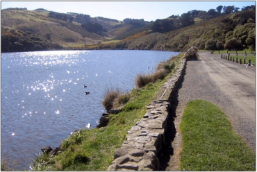
Eastern lagoon, Tomahawk Lagoon (September 2007) “51”
References
1 Otago Regional Council (2004) Regional Plan: Water for Otago. Published by the Otago Regional Council, Dunedin.
2. Ausseil, A.G., Newsome, P., Johnson, P, (2008) Wetland Mapping in the Otago Region. Landcare Research Contract Report prepared for the Otago Regional Council.
28. Dunedin City Council (1999) Dunedin City District Plan. Published by the Dunedin City Council, Dunedin.
51. Otago Regional Council - Photo Archive.
66. Johnson, P. (2004) Otago Peninsula Plants - An annotated list of vascular plants growing in wild places. Published by Save tje Otago Peninsula (STOP), Dunedin.
67. Otago Fisheries - Welcome to Otago Region. Retrieved from New Zealand Fish & Game. Online http://fishangame.org.nz/Site/Regions/Otago/fisheries.aspx.
