-
-
-
-
-
-
-
-
Otago’s future climate
-
-
-
-
-
-
-
Otago’s climate is changing. These changes will affect our people, our environments, our biodiversity and our economy.
It’s important to understand the potential impacts so we can build Otago’s climate resilience.
Best experienced on desktop.
You'll notice that these maps are based on two different future scenarios:
- SSP2-4.5 'Middle of the road'
- SSP5-8.5 'Fossil-fuelled development'
As we get closer to the projected year of 2100, we can see which scenarios are most similar to the actual path we are on. We now know that SSP5-8.5 is no longer considered to be a possible scenario, so we are working to map projections aligned with SSP3-7.0 'Regional rivalry'. These SSP3-7.0 maps will be available by the end of 2026 and will replace the SSP5-8.5 maps.
The following tools and reports can help us understand what changes are expected, and how this impacts our exposure to various natural hazards.
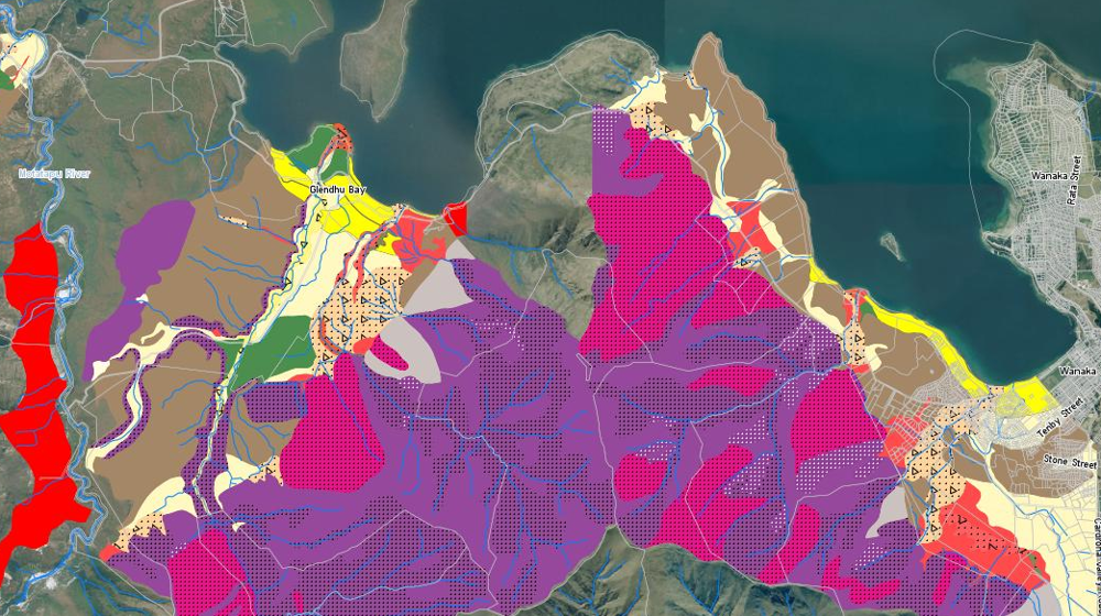
Otago Natural Hazards Database
Our hazards database is intended to improve public access to hazard information and to help the public, local authorities, and others make informed decisions about their exposure to natural hazards.

NZ Sea Rise Maps
Maps showing local and national sea level projections to the year 2300
Greenhouse gases trap heat within the Earth’s atmosphere and affect our climate.
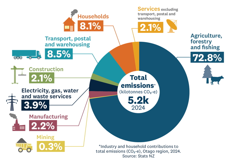
Nationally, Aotearoa New Zealand's major sources of greenhouse gas emissions are agriculture, manufacturing, households and transport/warehousing.
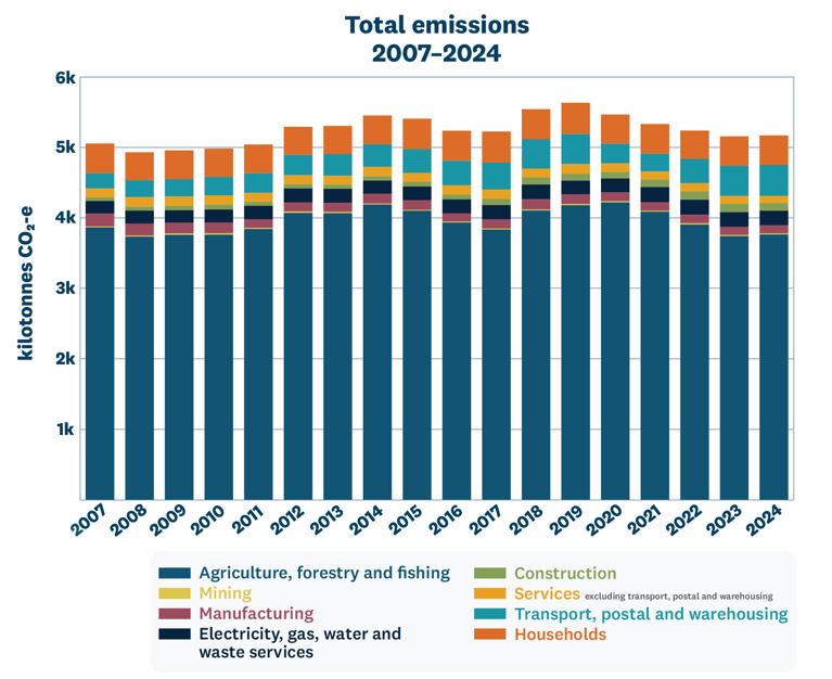
Otago’s emissions profile is unique and linked to the make-up of our local economy. The main greenhouse gas emissions sources in Otago are agriculture, transport/warehousing, and households. These emissions have been calculated back to 2007. We can see that emissions peaked in 2019, and have since been decreasing.

What we're achieving in Otago
An overview of Otago Regional Council’s climate resilience work, including adaptation programmes, emissions reduction initiatives, emergency readiness and partnerships with communities and organisations.

Climate-related risks
Climate-related risks are increasing as extreme weather, rising sea levels and warmer temperatures affect our environment, communities and economy. These impacts will not be felt evenly across our region.

What you can do
Ways you can take action on climate change in Otago, including household preparedness, reducing emissions, community initiatives, events and funding opportunities.

What’s happening nationally
Information linking national climate change policies and frameworks with Otago initiatives, including emissions reduction, adaptation planning, resilience research and funding programmes.


