-
-
-
-
-
-
-
-
-
-
Hukihuki Swamp
-
-
-
-
-
-
-
-
-
-
-
-
-
-
-
-
-
-
-
-
-
Hukihuki Swamp
Description:
A coastal rush/sedge/podocarp swamp. 1
Type/Class:
Swamp. 2
Size:
18.6 ha.
Altitude:
0 - 20 m above sea level.
Approximate location:
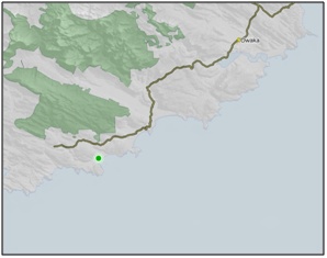
2 km Southwest of the intersection of Chaslands Highway and Cathedral Caves Road, Chaslands.
NZTM (centre point): E1321000 N4831500.
Regional Plan:
Schedule 9 Regionally Significant Wetland, no.62, Map F32.
Territorial Authority:
Clutha District Council.

Recorded Values:
Value |
Description |
|---|---|
A4 |
High degree of wetland naturalness. 2 |
A5 |
Scarce in Otago in terms of its ecological or physical character. Less than 15% of swamps remain in Otago. 2 |
A7 |
High diversity of indigenous wetland flora and fauna. A diverse and interesting assemblage of wetland plant species, including jointed wire rush/oioi (Leptocarpus similis), Carex sp. and Juncus sp., flax and red pine/rimu (Dacrydium cupressinum). 1 |
A1 - A3, A6, A8, A9 |
No relevant information is currently held by the ORC. |
Other Information:
- The Hukihuki Stream that flows through the swamp is classified as a Significant Wetland in the Clutha District Plan. Described as a rush and sedge Swamp, shrub bog and heathland, podocarp swamp, slow single-channel river, that forms part of a largely unmodified stream/estuary of Waipati. 37
References:
1 Otago Regional Council (2004) Regional Plan: Water for Otago. Published by the Otago Regional Council, Dunedin.
2 Ausseil, A.G., Newsome, P., Johnson, P. (2008) Wetland Mapping in the Otago Region. Landcare Research Contract Report prepared for the Otago Regional Council.
37 Clutha District Council (1998) Clutha District Plan. Published by the Clutha District Council, Balclutha.

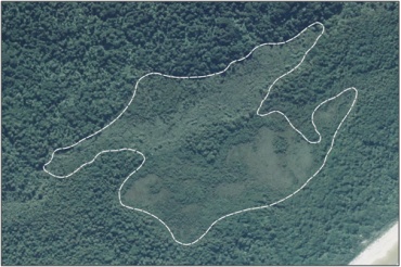
Aerial View of Hukihuki Swamp (March 2006)
Was this page helpful?
Page last updated 19 March 2024
Page last updated 19 March 2024
