-
-
-
-
-
-
-
-
-
-
Maclennan River Podocarp Swamp Complex
-
-
-
-
-
-
-
-
-
-
-
-
-
-
-
-
-
-
-
-
-
Maclennan River Podocarp Swamp Complex
Description:
Riparian white pine/kahikatea (Dacrycarpus dacrydioides), silver beech (Nothofagus menziesii) forest and pūkio (Carex secta) swamp adjacent to Maclennan River. 1
Type/Class:
Swamp and Marsh. 2
Size:
117.7 ha.
Altitude:
0 - 20 m above sea level.
Approximate location:
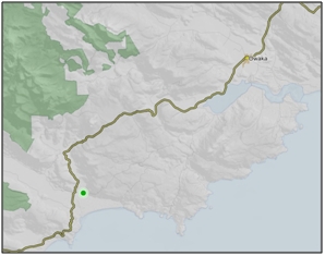
2.5 km Northeast of Papatowai.
NZTM (centre point): E1330400 N4840100.
Regional Plan:
Water for Otago.
Schedule 9 Regionally Significant Wetland, no.92, Map F50.
Territorial Authority:
Clutha District Council.

Recorded Values:
Value |
Description |
|---|---|
A4 |
High degree of wetland naturalness. |
A5 |
Scarce in Otago in terms of its ecological or physical character. . Wetland scarce in region in terms of its ecological character. Rare example of riparian white pine/kahikatea (Dacrycarpus dacrydioides) and silver beech (Nothofagus menziesii) forest. Along with Tahakopa River Bogs, this is the largest area of pūkio (Carex secta) swamp under reserve status in Otago. High regional scientific value. 1 Less than 15% of swamps and marshes remain in Otago. 2 |
A6 |
Highly valued by Kai Tahu for cultural and spiritual beliefs, values and uses, including mahika kai and waahi taoka. 1 |
A1 - A3, A7 -A9 |
No relevant information is currently held by the ORC. |
Other Information:
- Includes the Maclennan River Scenic Reserve and part of the Tahakopa Bay Scenic Reserve. 1
- Both the Maclennan River Scenic Reserve and the Tahakopa Bay Scenic Reserve are listed as Significant Wetlands in the Clutha District Plan. The Maclennan River Scenic Reserve is described as rush and sedge swamp, shrub swamp.
- The Maclennan River is a slow single-channel river.
- This wetland contains the largest stand of white pine/kahikatea (Dacrycarpus dacrydioides) in South East Otago. The Tahakopa Bay Scenic Reserve is described as shrub swamp, rush and sedge swamp, flax swamp, lowland lake. Described as a nationally significant forest sequence from swamp to high podocarp forest. 37

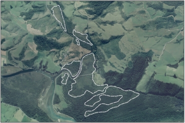
Aerial view of Maclennan River Podocarp Swamp Complex
References:
1 Otago Regional Council (2004) Regional Plan: Water for Otago. Published by the Otago Regional Council, Dunedin.
2 Ausseil, A.G., Newsome, P., Johnson, P. (2008) Wetland Mapping in the Otago Region. Landcare Research Contract Report prepared for the Otago Regional Council.
37 Clutha District Council (1998) Clutha District Plan. Published by the Clutha District Council, Balclutha.
