-
-
-
-
-
-
-
-
-
-
Ratanui Swamp
-
-
-
-
-
-
-
-
-
-
-
-
-
-
-
-
-
-
-
-
-
Ratanui Swamp
Description:
Swamp area at the edge of the Catlins Lake and Estuary and located within the Catlins Lake Scenic Reserve. 37
Type/Class:
Swamp. 2
Size:
5.4 ha.
Altitude:
0 - 20 m above sea level.
Approximate location:
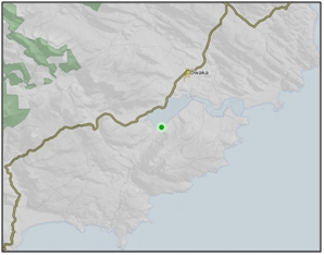
Immediately North and Northeast of the intersection of Purakanui Falls Road and Lakeside Road, 5 km Southwest of Owaka.
NZTM (centre point): E1341270 N4845900.
Regional Plan:
Water for Otago.
Schedule 9 Regionally Significant Wetland, no.126, Map F33.
Territorial Authority:
Clutha District Council.

Recorded Values:
Value |
Description |
|---|---|
A4 |
High degree of wetland naturalness. 2 |
A5 |
Scarce in Otago in terms of its ecological or physical character. Less than 15% of swamps remain in Otago. 2 |
A6 |
Highly valued by Kai Tahu for cultural and spiritual beliefs, values and uses, including mahika kai and waahi taoka. 1 |
A7 |
High diversity of indigenous wetland flora and fauna. High diversity of flora. 1 |
A1 - A3, A8, A9 |
No relevant information is currently held by the ORC. |
Other Information:
- Included in the Statutory Acknowledgement for Kuramea (Lake Catlins). 19
- Supports recreational fisheries for brown trout (Salmo trutta), whitebait/inanga (Galaxias spp.) and flounder (Rhombosolea sp.). It is also important as a whitebait/inanga spawning area. 53
- The Catlins Lake Scenic Reserve is listed in Schedule 6.1: Reserve and Conservation Land of the Clutha District Plan. 37
- Located adjacent to the Catlins Lake and Estuary, which is listed in the Clutha District Plan as a Significant Wetland with a Diverse Range of Avifauna and Botany. The Catlins Lake and Estuary is described as a large area of mudflats with associated wetland and saltmarsh, a habitat type much restricted in the region. 37
- Ratanui Swamp is adjacent to the coastal marine area, which is covered by the Regional Plan: Coast for Otago.

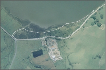
Aerial View of Ratanui Swamp (March 2006)
References:
1 Otago Regional Council (2004) Regional Plan: Water for Otago. Published by the Otago Regional Council, Dunedin.
2 Ausseil, A.G., Newsome, P., Johnson, P. (2008) Wetland Mapping in the Otago Region. Landcare Research Contract Report prepared for the Otago Regional Council.
19 Otago Regional Council (2009) Regional Plan: Coast for Otago. Published by the Otago Regional Council, Dunedin.
37 Clutha District Council (1998) Clutha District Plan. Published by the Clutha District Council, Balclutha.
53 Davis, S.F. (1987) Wetlands of national importance to fisheries. New Zealand freshwater fisheries report no. 90. Ministry of Agriculture and Fisheries, Christchurch.
