-
-
-
-
-
-
-
-
-
-
Rocky Hill Tidal Marshes
-
-
-
-
-
-
-
-
-
-
-
-
-
-
-
-
-
-
-
-
-
Rocky Hill Tidal Marshes
Description:
An area of wetland including marsh and river terrace plant communities on both sides of the Taieri River, about 3 km from its mouth. 1
Type/Class:
Tidal marsh. 2
Size:
3.2 ha.
Altitude:
0 - 40 m above sea level.
Approximate location:
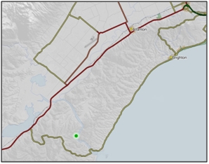
2.7 km Northwest of the intersection of Finlayson Road and Marine Parade, Milton.
NZTM (centre point): E1381250 N4898030.
Regional Plan:
Water for Otago.
Schedule 9 Regionally Significant Wetland, no.131, Map F43.
Territorial Authority:
Clutha District Council.

Recorded Values:
Value |
Description |
|---|---|
A3 |
High diversity of wetland habitat types. High variety of plant communities, some quite unique, eg. the marsh areas which have some salt and some fresh water marsh characteristics, and the small white pine/kahikatea (Dacrycarpus dacrydioides)–totara–black pine/mataī (Prumnopitys taxifolia) – brown pine/miro (Prumnopitys ferruginea) stand on the west river terrace. 1 |
A4 |
High degree of wetland naturalness. 1 |
A5 |
Scarce in Otago in terms of its ecological or physical character. Less than 15% of swamps remain in Otago. 2 |
A1 - A2, A6 - A9 |
No relevant information is currently held by the ORC. |
Other Information:
- The Rocky Hill Tidal Marshes and Governors Point Swamp (Schedule 9 Significant Wetland no.54) form a complex of wetland areas on either side of the Taieri River, just a few km upstream from the river’s mouth. This wetland complex is characterised its high diversity of habitat types and a unique variety of plant communities. 1
References:
1 Otago Regional Council (2004) Regional Plan: Water for Otago. Published by the Otago Regional Council, Dunedin.
2 Ausseil, A.G., Newsome, P., Johnson, P. (2008) Wetland Mapping in the Otago Region. Landcare Research Contract Report prepared for the Otago Regional Council.

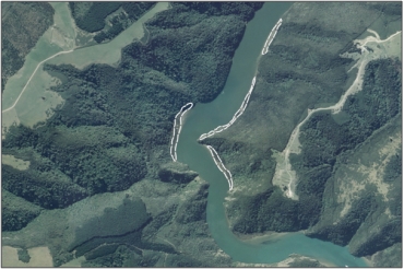
Aerial View of Rocky Hill Tidal Marshes (March 2006)
Was this page helpful?
Page last updated 19 March 2024
Page last updated 19 March 2024
