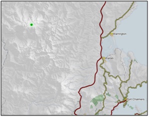
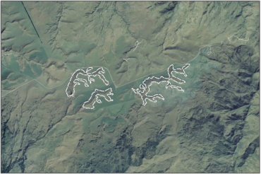
Areas of copper tussock wetland on gully floors in the southern part of Macraes Ecological District. 1
-
-
-
-
-
-
-
-
-
-
-
-
-
Lamb Hill Fen Complex
-
-
-
-
-
-
-
-
-
-
-
-
-
-
-
-
-
-
Lamb Hill Fen Complex
Description:
Type/Class:
Swamp and Fen 2
Size:
37.6 ha.
Altitude:
640-740 m above sea level.
Approximate location:
4.5 km Northeast of the intersection of Hindon Road and Silverpeaks Road, Clarks Junction.
NZTM (centre point): E1398430 N4936870
Regional Plan: Water for Otago.
Schedule 9 Regionally Significant Wetland, no.79, Map F53.
Territorial Authority:
Dunedin City Council.

Recorded Values:
Value |
Description |
|
|---|---|---|
| A4 |
|
|
A5 |
|
|
| A7 |
|
|
A1-A3, A6, A8, A9 |
No relevant information is currently held by the ORC. |
Other Information:
- Listed as an Area of Significant Conservation Value in the Dunedin City District Plan, where it is described as an estuary with mudflat, saltmarsh, and reed swamp, and succulent herb swamp, and of regional significance. 28
- Kaikorai Lagoon Swamp is adjacent to the coastal marine area, which is covered by the Regional Plan: Coast for Otago.

Aerial View of Lamb Hill Fen Complex (March 2006)
References:
1 Otago Regional Council (2004) Regional Plan: Water for Otago. Published by the Otago Regional Council, Dunedin.
2. Ausseil, A.G., Newsome, P., Johnson, P, (2008) Wetland Mapping in the Otago Region. Landcare Research Contract Report prepared for the Otago Regional Council.
