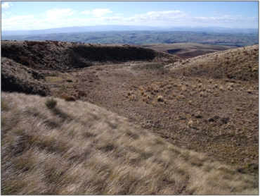
Area containing cushion herb vegetation, Sphagnum sp. bogs, flushes and small tarns on the summit and western slopes of Maungatua overlooking Taieri Plains. 1
-
-
-
-
-
-
-
-
-
-
-
-
-
Maungatua Summit Wetland Management Area
-
-
-
-
-
-
-
-
-
-
-
-
-
-
-
-
-
-
Maungatua Summit Wetland Management Area
Description:
Type/Class:
Fen 2
Size:
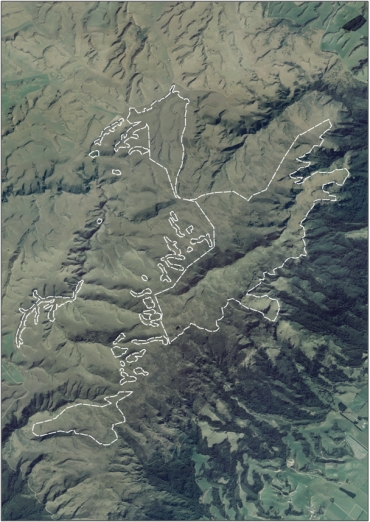
1,213 ha.
Altitude:
540-880 m above sea level.
Approximate location:
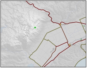
7 km West of Outram.
NZTM (centre point): E1376100 N4917000
Regional Plan: Water for Otago.
Schedule 9 Regionally Significant Wetland, no.99, Map F58.
Territorial Authority:
Dunedin City Council.

Recorded Values:
Value |
Description |
|
|---|---|---|
A4 |
High degree of wetland naturalness |
|
A5 |
|
|
| A6 |
|
|
A1-A3, A7-A9 |
No relevant information is currently held by the ORC. |
Other Information:
- Area of Significant Conservation Value in the Dunedin City District Plan. Described as a tarn restiad bog and tussockland cushion bog and of national significance. 28
- Small sized cushion bog areas occupy the poorly drained peaty depressions in snow-tussock grassland at a height of about 800m ASL on the summit-ridge. 95
- Some 10 different cushion plant species can be found in the wetland, together with an insectivorous sundew (Drosera arcturi) and several lichens. 95
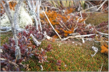
- The prominent rounded cushions are of Donatia novae-zelandiae. a species confined to cool peaty wetlands between the Tararua Range and Stewart Island. 95

Aerial view of Maungatua Summit Wetland Management Area (March 2006)

Maungatua Summit Wetland Management Area (September 2009) “51”

Pentachondra pumila (maroon), Donatia novae-zelandiae (green), and Lycopodium fastigiatum (orange) “51”
References:
1 Otago Regional Council (2004) Regional Plan: Water for Otago. Published by the Otago Regional Council, Dunedin.
2. Ausseil, A.G., Newsome, P., Johnson, P, (2008) Wetland Mapping in the Otago Region. Landcare Research Contract Report prepared for the Otago Regional Council.
28. Dunedin City Council (1999) Dunedin City District Plan. Published by the Dunedin City Council, Dunedin.
51. Otago Regional Council - Photo Archive.
95. Stephonson, G.K, Card., et al. (1983) Wetland: A Diminishing Resource (A Report for the Environmental Council, Water and Soil Miscellaneous Publication No.58. Published by the Ministry of Works and Development - Water and Soil Division, Wellington.
