None available
-
-
-
-
-
-
-
-
-
-
-
-
-
McLachlan Road Marsh
-
-
-
-
-
-
-
-
-
-
-
-
-
-
-
-
-
-
McLachlan Road Marsh
Description:
Type/Class:
Marsh 2
Size:
10.18 ha.
Altitude:
0-20 m above sea level.
Approximate location:
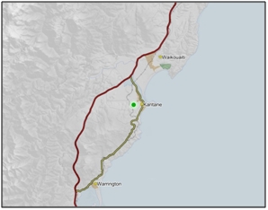
Southeast of the intersection of Round Hill Road and McLachlan Road, Karitane.
NZTM (centre point): E1416540 N4943140
Regional Plan: Water for Otago.
Schedule 9 Regionally Significant Wetland, no.102, Map F56.
Territorial Authority:
Dunedin City Council.

Recorded Values:
Value |
Description |
|
|---|---|---|
A5 |
|
|
A1-A4, A6-A9 |
No relevant information is currently held by the ORC. |
Other Information:
Included in the Statutory Acknowledge for Te Tauraka Poti (Merton Tidal Arm). This was a major mahinga kai for kainga and pa located on the coast north of the Otago Peninsula. The wetlands were a rich source of kai, including tuna (eels), black flounder (Rhombosolea retiaria), giant kokopu (Galaxias argenteus) and waterfowl. The wetlands were particularly valued as a spawning ground for whitebait/inaka (Galaxias spp.). 19

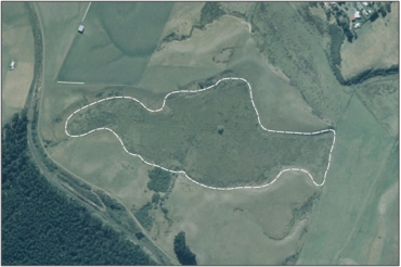
Aerial view of McLachlan Road Marsh (March 2006)
References
2. Ausseil, A.G., Newsome, P., Johnson, P, (2008) Wetland Mapping in the Otago Region. Landcare Research Contract Report prepared for the Otago Regional Council.
19. Otago Regional Council (2009) Regional Plan: Coast for Otago. Published by the Otago Regional Council, Dunedin.
