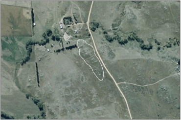
A salt pan on gently sloping surface of the Tor Plateau land system, the pan grading into a small wet area at one end. 1
-
-
-
-
-
-
-
-
-
-
-
-
-
Murrays Road Inland Saline Wetland Management Area
-
-
-
-
-
-
-
-
-
-
-
-
-
-
-
-
-
-
Murrays Road Inland Saline Wetland Management Area
Description:
Type/Class:
Inland saline 2
Size:
1.5 ha.
Altitude:
180-200 m above sea level.
Approximate location:
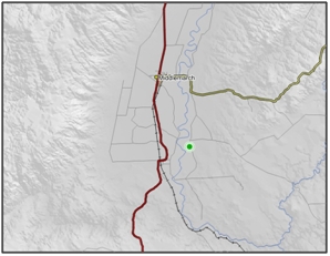
South of the intersection of Longford Road and Murrays Road, Middlemarch.
NZTM (centre point): E1377490 N4951570
Regional Plan: Water for Otago.
Schedule 9 Regionally Significant Wetland, no.111, Map F51.
Territorial Authority:
Dunedin City Council.

Recorded Values:
Value |
Description |
|
|---|---|---|
A5 |
|
|
A1-A3, A6, A7, A9 |
No relevant information is currently held by the ORC. |
Other Information:

Aerial View of Murrays Road Inland Saline Wetland Managment Area (March 2006)
References
1 Otago Regional Council (2004) Regional Plan: Water for Otago. Published by the Otago Regional Council, Dunedin.
2. Ausseil, A.G., Newsome, P., Johnson, P, (2008) Wetland Mapping in the Otago Region. Landcare Research Contract Report prepared for the Otago Regional Council.
