-
-
-
-
-
-
-
-
-
-
-
-
Signal Hill Swamp
-
-
-
-
-
-
-
-
-
-
-
-
-
-
-
-
-
-
-
Signal Hill Swamp
Description:
Signal Hill Swamp.
Type/Class:
Not identified. 2
Size:
1.7 ha.
Altitude:
420 - 460 m above sea level.
Approximate location:
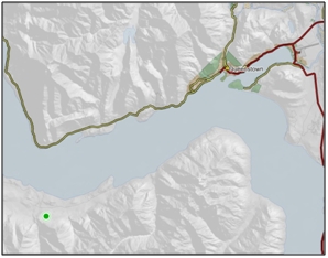
1 km Southeast of the intersection of Von Road and Mount Nicholas Beach Bay Road, Walter Peak.
NZTM (centre point): E1243950 N4992700.
Regional Plan:
Water for Otago.
Schedule 9 Regionally Significant Wetland, no.138, Map F8.
Territorial Authority:
Queenstown Lakes District Council.

Recorded Values:
Value |
Description |
|---|---|
| A1 - A9 | No relevant information is currently held by the ORC. |
References:
2 Ausseil, A.G., Newsome, P., Johnson, P. (2008) Wetland Mapping in the Otago Region. Landcare Research Contract Report prepared for the Otago Regional Council.

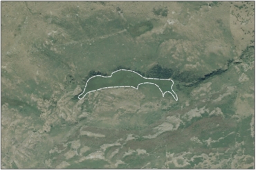
Aerial View of Signal Hill Swamp (February 2006)
Was this page helpful?
Page last updated 19 March 2024
Page last updated 19 March 2024
