-
-
-
-
-
-
-
-
-
-
-
Red Bank Wetland Management Area
-
-
-
-
-
-
-
-
-
-
-
-
-
-
-
-
-
-
-
-
Red Bank Wetland Management Area
Description:
Copper tussock wetland and a low turf ephemeral tarn on the western ridge crest in the upper catchment of a tributary of the North Branch of the Waikouaiti River. 1
Type/Class:
Swamp. 2
Size:
121.8 ha.
Altitude:
480 - 620 m above sea level.
Approximate location:
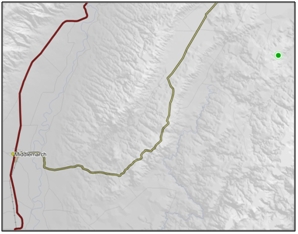
5 km South of the intersection of Red Bank Road and Macraes Road, Macraes Flat.
NZTM (centre point): E1398400 N4966000.
Regional Plan: Water for Otago
Schedule 9 Regionally Significant Wetland, no.127, Map F62.
Territorial Authority:
Waitaki District Council.

Recorded Values:
Value |
Description |
|---|---|
A1 |
Habitat for nationally or internationally rare or threatened species or communities. The threatened plant species Isolepis basilaris and Myosurus minimus subsp. novae zelandiae are present in the low turf ephemeral tarn. 1, 2 |
A4 |
High degree of wetland naturalness. 1 |
A5 |
Scarce in Otago in terms of its ecological or physical character. Less than 15% of swamps remain in Otago. 2 |
A7 |
High diversity of indigenous wetland flora and fauna. A high diversity of wetland species. A diverse and interesting aquatic insect fauna in seepages and creeks, including the brown caddis (Psilochorema tautoru). 1 |
A2, A3, A6, A8, A9 |
No relevant information is currently held by the ORC. |
References:
1 Otago Regional Council (2004) Regional Plan: Water for Otago. Published by the Otago Regional Council, Dunedin.
2 Ausseil, A.G., Newsome, P., Johnson, P. (2008) Wetland Mapping in the Otago Region. Landcare Research Contract Report prepared for the Otago Regional Council.
12 Waitaki District Council (2004) Waitaki District Plan. Published by the Waitaki District Council, Oamaru.

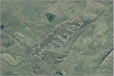
Aerial View of Red Bank Wetland Management Area (March 2005)
