-
-
-
-
-
-
-
-
-
-
-
Tavora Wetland
-
-
-
-
-
-
-
-
-
-
-
-
-
-
-
-
-
-
-
-
Tavora Wetland
Description:
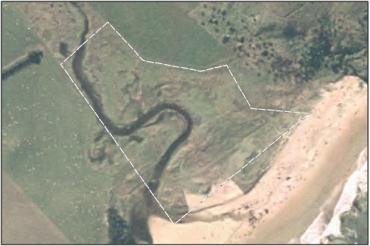
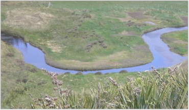
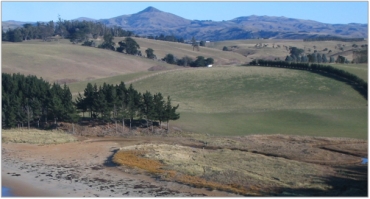
The wetland at Tavora is a very small coastal lagoon, impounded behind a beach sand dune in association with the mouth of Tavora Stream. 109
Type/Class:
Saltmarsh on the margins of stream mouth lagoon. 109
Size:
2.23 ha
Altitude:
0 - 20 m above sea level.
Approximate location:
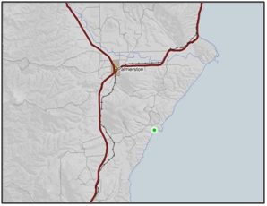
East Otago 60 km north of Dunedin and 10 km east of Palmerston.
NZTM (centre point): E1424888 N4955633
Regional Plan: Water for Otago
Schedule 9 Regionally Significant Wetland, no.173, Map F61
Territorial Authority:
Waitaki District Council

Recorded Values:
Value |
Description |
|---|---|
A1 |
Habitat for nationally or internationally rare or threatened species or communities. Habitat for Mimulus repens (Naturally uncommon) and feeding habitat for White Heron (Nationally Critical). 109 |
A5 |
Scarce in Otago in terms of its ecological or physical character. Coastal lagoons are rare ecosystems in Otago and nationally. 109 |
A2-A4, A6-A9 |
No relevant information is currently held by the ORC. |
Other Information:
- The wetland is part of a 40ha coastal strip and riparian reserve owned and managed for conservation by the Yellow-eyed Penguin Trust since 1993. 28 hectares are leased for grazing, while 12 hectares of the coastal strip and the riparian strip alongside Tavora Creek are managed for conservation. 107
- The reserve was placed under a Department of Conservation covenant in 1996, and is advised by a committee comprised of the Yellow-eyed Penguin Trust, DoC, Kati Huirapa Runanga ki Puketeraki and a representative of the local community. 107
- The reserve’s management’s objectives, contained in the Tavora Reserve Statement of Management Intent are to manage yellow-eyed penguin habitat, to foster the conservation of other species, and to provide a limited range of recreational opportunities for the public. 107
- With regard to the vegetation management specifically, the 1996 plan had the following objective: “Re-establish and allow natural regeneration of coastal vegetation communities similar to that which previously existed in the area. These may include coastal forest, shrublands, wetlands, cliff and dune communities.” 108
- At the time of the purchase, as for other beaches of the area, intensive farming practices had modified much of the native vegetation. A restoration programme is being carried out with the help of other organizations (DoC, Malcam Conservation Corps, Kiwi Conservation Club) and individual volunteers. 106
- Restoration of the wetland’s values includes stock proof fencing and revegetation work on the wetland’s margins.
- Native plant species observed in the wetland area include glasswort, bachelors’ button, Leptinella Diocia, three cornered sedge and some shrubs (saltmarsh ribbonwood). Flax, manuka and ngaio have been planted. 106
- Riparian planting undertaken along the stream has improved water quality. Planting included flax, pittosporum sp, cabbage tree and Hall’s totara. 106
- Native eels, galaxiids, grey herons, spotted shags, and paradise ducks have been observed in the wetland area. 106
- The area is open to the public, and walking tracks with informative signage have been developed.
References:
2 Ausseil, A.G., Newsome, P., Johnson, P. (2008) Wetland Mapping in the Otago Region. Landcare Research Contract Report prepared for the Otago Regional Council.
106 Yellow-eyed Penguin Trust. Tavora Reserve Guided Walk. Retrieved from the Yellow-eyed Penguin Trust website. http://yellow-eyedpenguin.org.nz/our-work/habitats/tavora/.
107 Yellow-eyed Penguin Trust.(2009) Fact Sheet - Tavora.
108 Correspondence with David McFarlane – Yellow-eyed Penguin Trust. (2012) Document ID A480575.
109 Pers comm. John Barkla.(2012) Document ID A480573.


