The ORC is placing the buoys in locations that have depths of approximately 350 metres Whakatipu and 220 metres in Wānaka, understood to be deepest tethered freshwater quality monitoring buoys in the country, says ORC’s Scientist-Lakes, Hugo Borges.
“They’ll become a key part of our overall lakes monitoring programmes focused on monitoring water quality,” he says.

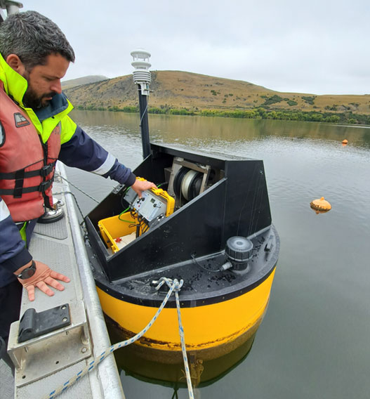
ORC’s Scientist-Lakes, Hugo Borges, on Lake Hayes with a Limnotrack buoy.
The buoys, manufactured in Cambridge by Limnotrack Ltd, operate entirely remotely and will transmit data to ORC databases in near real-time.
Parameters measured throughout the water column, from the surface to 120 metres depth, include water oxygen levels, phytoplankton (algae) growth, water temperature, conductivity, and lake-water clarity.
An additional oxygen and temperature sensor will also be deployed near the lakebed from which data will be collected periodically.
Mr Borges says the valuable data set will allow ORC scientists to monitor changes in the water over time, including plumes during storm events.
Access to buoy data
Once in place, the public will be able to access the data, as will universities, environmental organisations and lake managers who are researching waterway projects.
Of likely high interest to the public will be relaying of near real-time weather conditions from a meteorological station on each buoy.
“A weather station mounted on the buoy will also provide near real-time data on meteorological parameters,” he says.
The buoys are 120-150 kg each and are 1200 mm in diameter by about the same height; above the water. The Wānaka buoy will be at the mouth of Roys Bay, and the Lake Whakatipu buoy, approximately 500 m offshore from Island Spur on Cecil Peak and 1.8 kilometres east of Hidden Island.


“The chosen sites in these nationally significant water bodies will provide us with baseline monitoring, to assess changes in the lakes due to climate change, or other factors such as catchment development,” Mr Borges says.
Each solar powered buoy will lower and raise a water quality sensor, by electric winch, several times a day to measure water quality parameters throughout the water column down to 120 metres depth.
The ORC intends to operate the monitoring buoys permanently as a part of our long-term State of the Environment monitoring programmes. Though, as technology changes, the methods of monitoring may change in future. ORC has a 35-year resource consent from QLDC for the buoys and moorings along with licences with LINZ for use of the lake beds.

Mooring system
The three-point mooring system has been designed by Christchurch engineering company Offshore and Coastal Engineering Ltd, who are specialists in deep water mooring systems.
They will also manage the construction and installation of the moorings along with their specialist marine construction sub-contractor Sub Aqua Solutions Ltd, with local boat support from Southern Monitoring Services Ltd.
Due to the function of the winch operated profiling sensors, directly below the buoy, a three-point spread mooring system is used.
Each monitoring buoy is held in place by three cylindrical spar buoys which are anchored to the lakebed. For navigation purposes, the buoys will have LED beacons and marks.
It is recommended all watercraft stay at least 50m away from the monitoring and marker buoys, to avoid any disturbance of the mooring system.
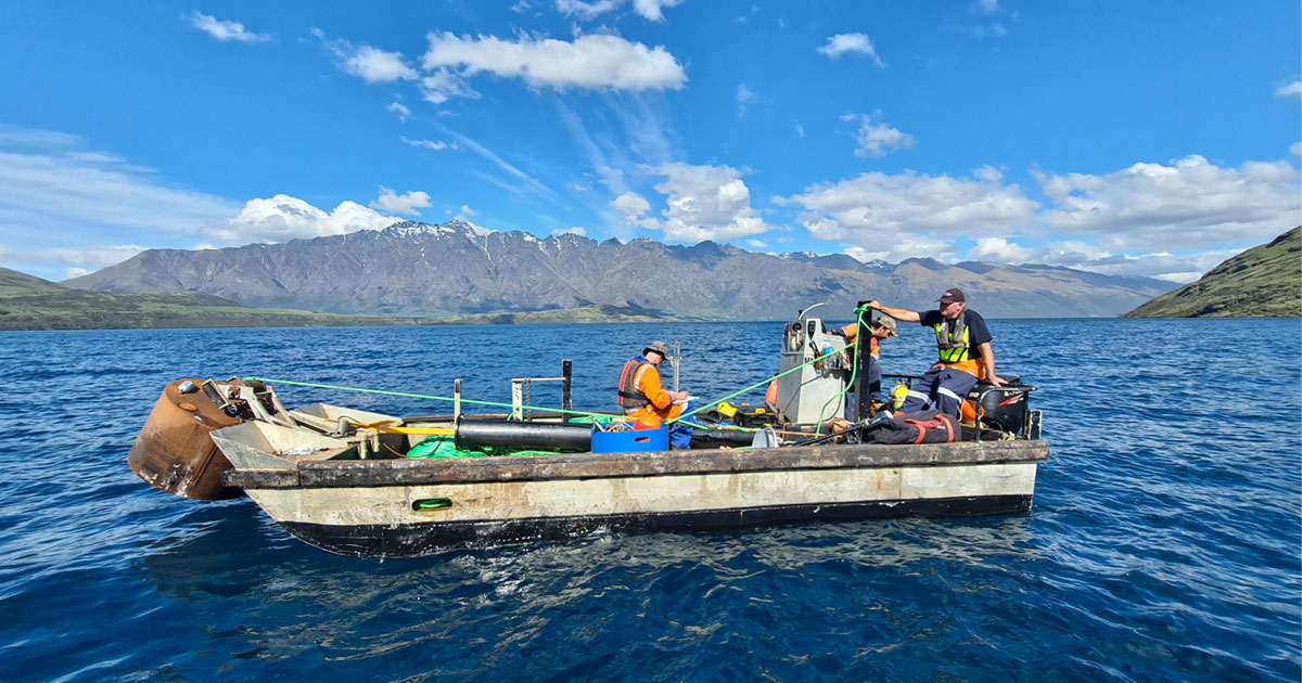
Each of the mooring systems and monitoring buoys will be put in place over one to two days, depending on lake and weather conditions, using three craft.
Earlier buoy deployment in Lake Hayes
ORC have a Limnotrack buoy in place at Lake Hayes, at a depth of 30 metres, which has been operating since July 2019.
As a result of a review of ORC’s environmental monitoring programmes, at least one more buoy is being considered for deployment to Lake Hawea, during the 2022-2023 financial year.
The Limnotrack system is a specialist bespoke product developed and supported in New Zealand and is adaptable to different conditions.
“This has allowed us to see the stratification in the [Lake Hayes] water column every summer, where we’ve been able to see algal blooms developing,” Mr Borges says.
Despite the fully autonomous operation of the buoy system, they require regular maintenance and verification of the data through comparison with manually collected and laboratory analysed samples.
This work will be undertaken by the ORC Senior Environmental Technician – Lakes, based in the Queenstown office.
The two new buoys at Wānaka and Whakatipu are being leased from Limnotrack for the first two years, which includes technical support, and Mr Borges says this arrangement may be reviewed in the future.
More than a dozen Limnotrack buoys have been deployed around the country, including for regional and district councils, Fish & Game councils, energy companies, private trusts, and landowners, the company says.
