The high-resolution 3D ground elevation data for the Manuherekia Catchment in Central Otago is now available online via the LINZ Data Service and Open Topography web sites, says Otago Regional Council’s Spatial Analyst, Andrew Welsh.
“The completion of this geospatial dataset mapping is an invaluable tool in identifying, mapping and managing natural hazards, be it flooding, erosion or landslips,” he says.
Similar, earlier ground elevation datasets for the Dunedin and Mosgiel urban areas and Otago’s Coastal Catchments were made publicly available in respectively mid-2022 and earlier this year. This Central Otago segment completes the capture for the Toitū Te Whenua Land Information New Zealand (LINZ) Provincial Growth Fund (PGF) LiDAR Project in Otago.
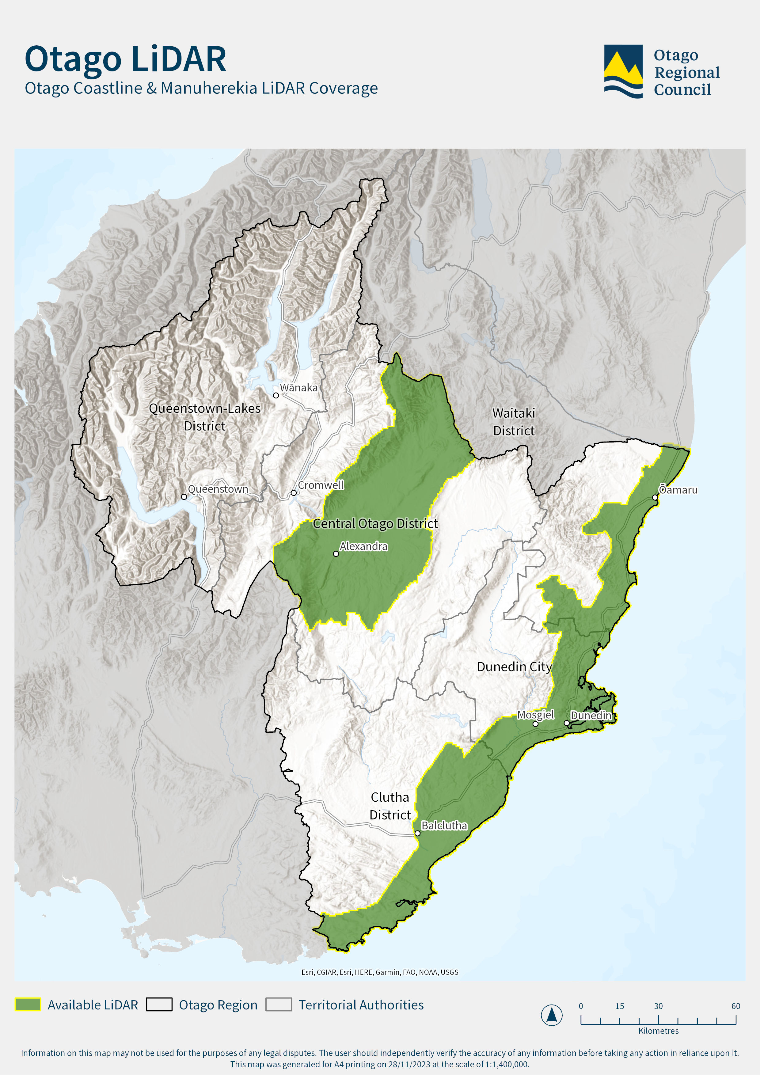
The combined Dunedin and Mosgiel, Coastal Otago and Manuherekia Catchment data sets now cover more than 8190 km2 of land.
Co-funding from the PGF, managed by MBIE’s Kānoa Regional Economic Development and Investment Unit, is supporting the substantial regional expansion of the New Zealand National Elevation Programme.
The programme is based on partnerships between Toitū Te Whenua and 10 councils and is using LiDAR (light detection and ranging) technology to capture high-definition data about the shape of the land.
“In terms of studying natural hazards, the LiDAR mapping is extremely useful for investigating and assessing the characteristics of natural hazards,” Mr Welsh says.

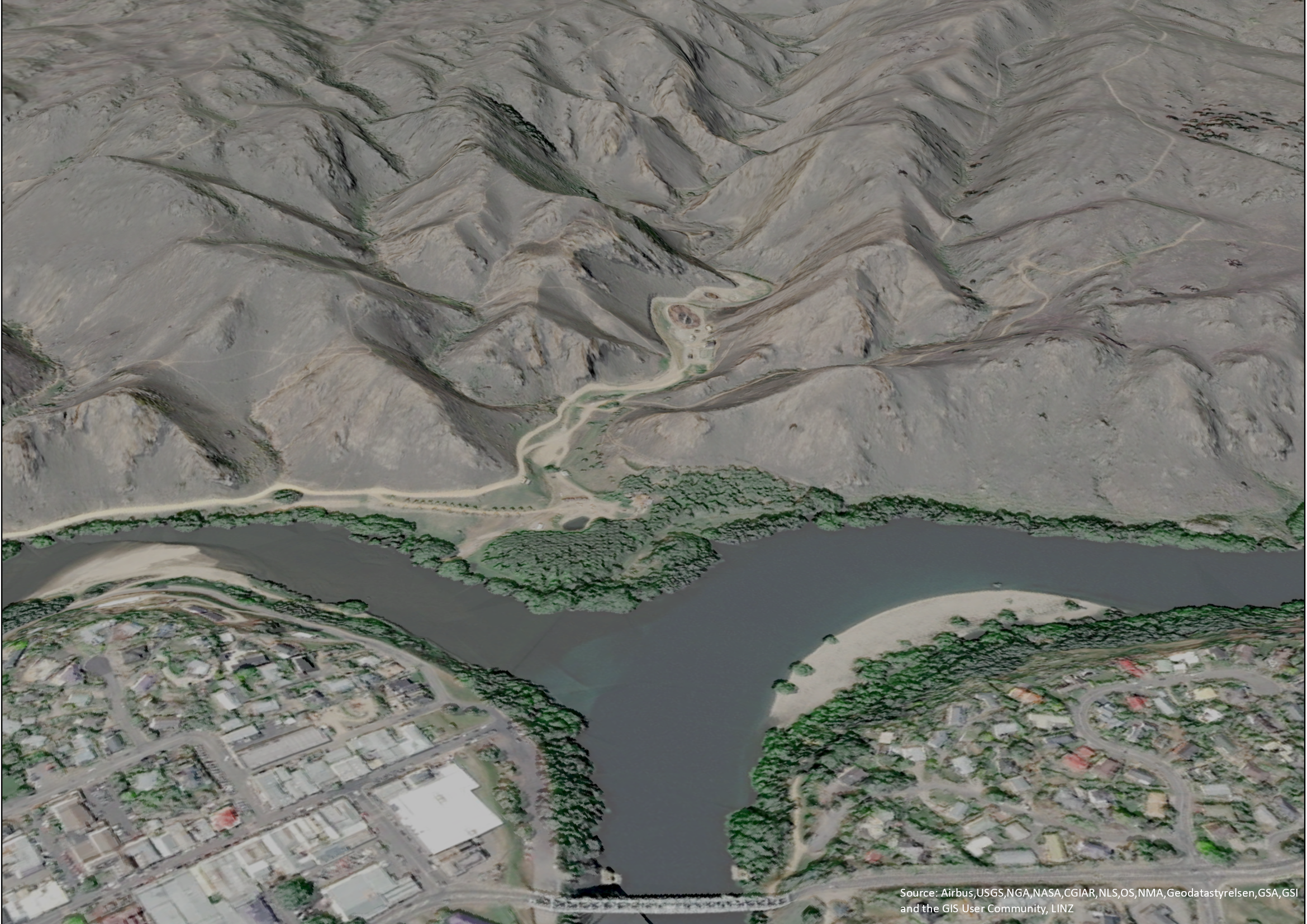
Pictured: High resolution LiDAR DSM image blended with aerial imagery - Looking towards Graveyard Gully from the Alexandra Bridge, Alexandra
Previous LiDAR capture in the Central Otago area focussed on the Manuherekia River floodplain and covered approximately 530 km2. The newly available dataset covers a much greater area and be at a higher resolution than previous captures – 4 elevation points per square metre as opposed to 2 points per square metre in previous captures.
“This will allow for a more detailed look at the shape and characteristics of the ground surface in the Central Otago district,” Mr Welsh says.


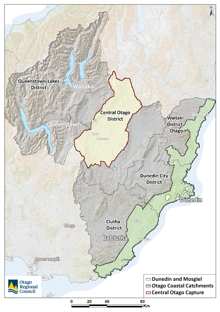
Pictured: Capture extent for the Central Otago LiDAR dataset is shaded in yellow-brown, the Otago Coastal Catchments capture in shown in green and the Dunedin-Mosgiel capture in yellow, respectively
Toitu Te Whenua Location Data Analyst Abbey Douglas was asked how LiDAR can assist with floods, as has been seen recently across the North Island.
“LiDAR provides accurate, high-resolution elevation of the ground surface, which is essential for reliable river and stormwater flood modelling. Such models are critical for planning and developing infrastructure which is resilient to flood events,” she says.

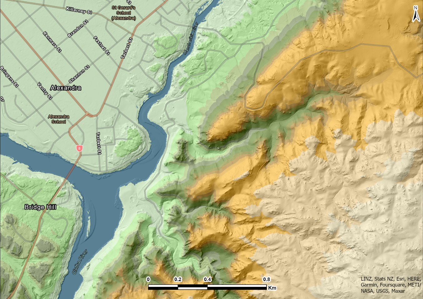
Pictured: Digital Elevation Model of the Manuherekia and Clutha Rivers near Alexandra; dark blue and lighter greens are lower elevation and yellow-browns comparatively higher
The LINZ Data Service
Toitū Te Whenua Senior Technical Leader Elevation and Imagery Bjorn Johns says the PGF LiDAR project will ultimately result in detailed three-dimensional imagery for 80% of the country once it is completed in 2024.
He says having baseline elevation data for so much of the country will make it easier to assess changes after major events. The significant alterations in the terrain caused by weather and other events, such as earthquakes, also makes a compelling case for ongoing LiDAR so public data remains up to date.
Coverage through the PGF LiDAR project is now at 60% of New Zealand with the data freely available on the LINZ Data Service, one of the agency’s channels for publicly available data.
Mr Welsh says the data LiDAR generates is invaluable in understanding and preparing for natural hazards, plus informing around infrastructure management, hydrology, catchment planning, and in many other applications.
“The LiDAR data can be visualised in a number of ways to enhance our understanding of the ground surface and build informative maps for an area of interest, such as using the point cloud to discriminate between different surface types, to using 3D digital terrain representations of the surface to model flood water pathways.”
“This will enhance our understanding of earth surface processes and potentially help to inform risk mapping and planning decisions,” he says.
Many groups can benefit from using the data set, including ecologists for wetland mapping or for engineers to inform flood protection planning. It provides farm-scale land information to benefit the agriculture and forestry sectors, and is widely used for development, engineering, architecture, and design applications by the private sector.
How the aerial data capture works
A LiDAR sensor onboard a fixed wing plane emits pulses of light to the ground surface as the plane flies over the area of interest. The pulses are then reflected by the surface back to the sensor and individual elevation measurements are recorded, based on the time each pulse takes to return to the sensor.
The pulse allows for discrimination between different surface types and ground features, such as trees and buildings, against the bare earth ground surface.
Links to the LiDAR dataset
Links for examples of LiDAR
- More about the Toitū Te Whenua LINZ LiDAR elevation data programme
- See topographic data from throughout New Zealand on the LINZ Data Service
