The 62-page report by consultants Tonkin + Taylor Ltd; Taieri Flood Protection Scheme, Floodbank Risk Assessment, is available on ORC’s web site, an agenda item for the Safety & Resilience Committee meeting next Thursday, 8 February.
Councillors will be asked to note the report and recommend that the wider programme of work continues.
ORC’s Manager Engineering Michelle Mifflin says the report was commissioned to further understand the risk associated with floodbank failure and the impact on surrounding areas if failure occurred.
This helps inform the approach required and which mitigation measures should be prioritised through ongoing work, she says.
“We’re sharing this report to keep the public up to date on our wider programme of asset management and resilience work for the Lower Taieri Flood Protection Scheme, and sharing new elements of this work as they are completed, including this risk assessment report.”
ORC is planning to hold community information sessions about the report, with dates to be confirmed and advertised.
“This flood protection scheme is in parts more than a century old, and regardless of the report, work is on-going to assess its stability and effectiveness and current resilience to weather or other seismic, natural hazard related events,” she says as reassurance to Taieri Plains landowners.
Ms Mifflin notes since high-profile floods in the 1980s through to more recent events, the floodbanks had “largely performed well” but highlights that ongoing work on flood protection assets is best practice in asset management.
The report highlights comparative risks; ranging from very low, low, medium, high, very high to extreme for each section of floodbank.
The risk rating enables prioritising floodbank sections, focusing on higher risks first, in risk mitigation investigations.
The report’s risk assessment findings will assist with the next stages of work such as prioritising potential floodbank improvements, guiding further assessments, understanding the tolerable risk and considering future adaptation plans, she says.
She says while the scheme has largely performed well during the past century, it remains “prudent to establish the relative risks” present in the scheme in its current condition, based on the last known “significant” flood, which was the 1980 event, Ms Mifflin says.
Two ‘extreme’ risk sections identified
While the findings of the report have identified areas of risk, it is important to note that understanding risk is key to informing ongoing work programmes, from monitoring and maintaining the floodbanks, through to physical works to improve resilience where needed.
The report findings will also inform flood preparedness and response planning that occurs together with emergency management and natural hazards functions, all with the aim of increasing resilience of communities over time.
Our current and future Long-term Plan provide for programmes of work for ongoing risk monitoring, as well as further detailed investigations to aid future planning and prioritisation.
Ms Mifflin says the report identified two ‘extreme’ risk sections in the Waipori floodbank, downstream of the Contour Channel, which related to variation in height of some of the floodbanks, and intruding trees in the floodbanks, which while were a factor, the risk was largely defined by the impact on the airport – a vital lifeline to the region.
She says once ORC became aware of the extreme risk rating for these two sections, they were investigated by staff immediately, and risk mitigation plans put in place, including addressing aspects which could be quickly actioned, such as tree removal and remediation.
“For the remaining risks a risk mitigation investigation is planned, triaged on the severity of their risk rating. This will involve reviewing the drivers of failure ratings and which mitigation measures can be implemented,” she says.
Any areas which require more detailed planning have been prioritised with current planned works, Ms Mifflin says.
“We’re letting the public know that we’re updating our understanding of risk in the area and that this new understanding is being used in our asset management programmes,” she says.
That management includes understanding the infrastructure’s condition and performance, routine inspection and maintenance activities, plus any renewals and changes to be considered.
Project scope and the Lower Taieri Flood Protection scheme
“We need to better understand the risk associated with the current operation of the scheme by examining the condition, performance, and consequences of failure,” she says.
Ms Mifflin says while the scheme does work to reduce the flood risk, “residual risk” remains for the parts of the Taieri Plains reliant on floodbanks for some flood mitigation, noting the possibility can never be eliminated of the floodbanks being overtopped or breached under flood conditions.
Ms Mifflin says it is usual for constructed assets such as floodbanks to have some defects influenced by historical construction methods, dispersive soils, new understandings of soil and structure interaction, weaknesses in imbedded structures, including pumping stations, and climate change such as more frequent weather events.
“All of these play a part in floodbank assets having defects needing to be dealt with through maintenance and renewal programmes,” she says.
“Throughout the lifetime of ORC’s Infrastructure Strategy, capital expenditure has been assigned to projects which aim to increase the resilience of flood protection infrastructure on the Lower Taieri; such as the Contour Channel Resilience Upgrade, Lower Taieri adaptation works and Outram resilience improvements.”
Operational expenditure is also given for maintaining a Flood Preparedness and Response Plan, aimed to further raise resilience by working alongside Civil Defence Emergency Management and ORC’s Natural Hazards team to prepare communities to respond to flood events and potential consequences.
Investigation works at Outram
The report is part of a workstream that is part of an ongoing asset management programme of work which sees ongoing performance monitoring and condition assessments informing risk assessments into the future; informing ORC and stakeholders.
As part of the wider programme of asset management work investigations will commence later in February 2024 at one of ORCs oldest floodbank assets, at Outram. A drilling and site-testing programme is scheduled to begin on the 1.5-kilometre Outram floodbank.
Ms Mifflin says while there are no immediate concerns with the Outram floodbank’s integrity, there are historical reports of some seepage through parts of the floodbank during flood events.
“The construction records are few and far between, as is information on the materials used on the floodbank over many, many years,” she says.
Some sections of floodbank were constructed in the late 1800s using horse and cart, with likely a variety of construction materials used during that period.

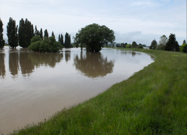
Floodbank at Outram during 2018 flood event – looking downstream
Ms Mifflin says while the investigation is “business as usual” for the Engineering team, she is “excited” what the drill programme and modelling will reveal of the underground geology and hydrology, and the Outram floodbank’s material make-up and history.
Of “key interest” to the Engineering team is the now invisible former water channels of the Taieri River, some of which lie under the floodbank and which at flood times can channel water underground and cause ponding on the landward side of the floodbank, she says.
These projects, and others including the development of the ORC’s 30-year Infrastructure Strategy, will assist in building greater resiliency in the face of climate change for our communities with critical infrastructure.
The ORC continues to engage with the Government on climate resilience funding to assist with infrastructure projects that are considered priority upgrades and renewals.
“This helps with funding available to continue upgrades and renewals to infrastructure to ensure we have the resilience from our current assets as we adapt to the challenges of a changing climate.
Background the Lower Taieri Flood Protection Scheme
The Taieri Plains has three significant watercourses crossing it; the Taieri River, Silver Stream and the Waipori River along with smaller watercourses including the Owhiro Stream, Mill Creek, Meggat Burn and Quarry Creek.
The floodplain has a catchment area of 565,000 hectares making it the second largest catchment in Otago, with about 6082 ha of the floodplain at or below current mean sea level.
The Lower Taieri Flood Protection Scheme provides flood mitigation to an area of about 18,000 ha of the Taieri plain, with floodbanks extending about 109 kilometres in length.
It protects farming areas, Mosgiel, Outram and Momona townships, and Dunedin International Airport.
Ms Mifflin says the scheme relies on the temporary detention of floodwaters within defined ponding areas, and spillways and flood ways to manage flows in an orderly way.


